New World Views
Map collection charts course of understanding
The spirit of discovery moved Dr. Seymour I. Schwartz nearly as much as it did Columbus, Vespucci and Magellan.
Those explorers sailed uncharted waters and probed lands never before seen by Western eyes. Schwartz, a New York surgeon, started with a 50-cent book titled Maps and Mapmakers and discovered a passion for the charts that brought a brave new world into clearer focus.
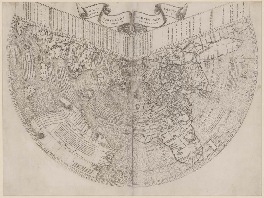
“On the Map,” a collection of Schwartz’s North American maps on display at the Albert and Shirley Small Special Collections Library, enables people to see not only the progression of understanding about these new lands, but also the parallel advancements in cartography, printing and navigation. From one of the earliest maps showing the Western hemisphere, by Johann Ruysch in 1508, to a sketch of the Ohio River Valley by 21-year-old George Washington, the evolution of knowledge itself is mapped in these images.
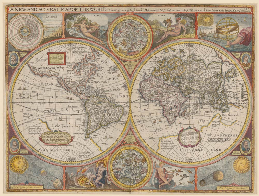
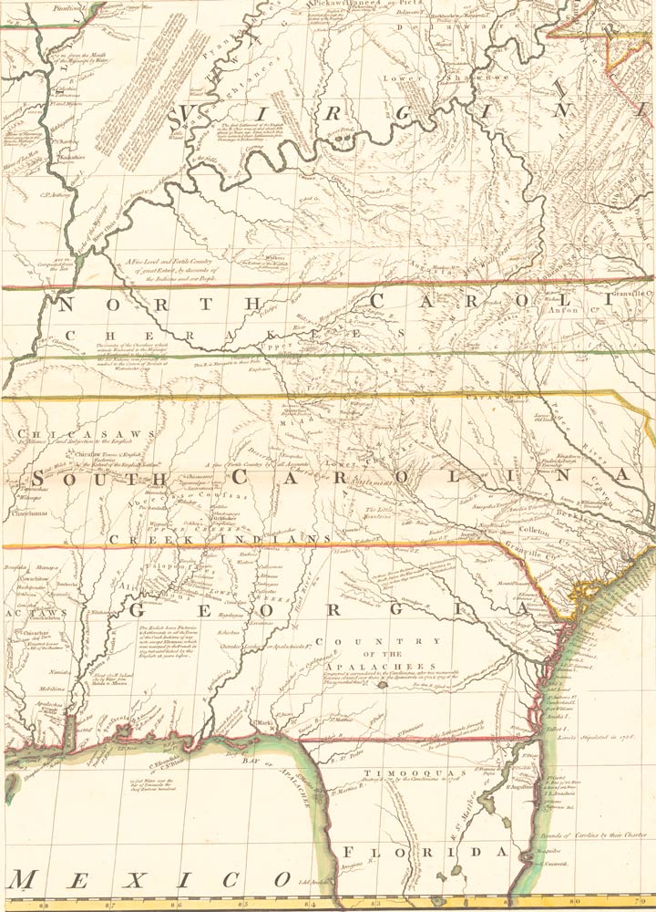
Some, such as a 1651 map showing Virginia only a 10-day march from the Pacific Coast, lack veracity. “A lot of the maps are wishful thinking; this is a classic case of wishful thinking,” says exhibits coordinator Mercy Quintos Procaccini (Col class of ’94). Others reflect more critical standards, such as the 1676 map “drawne according to the truest Descriptions, latest Discoveries and best Observations.”
UVA faculty members in media studies, art history and languages have used the map collection for coursework, but lessons learned extend far beyond Grounds. “Dr. Schwartz’s generosity makes it possible for faculty, students and scholars around the world to use these wonderful materials for research, teaching and inspiration,” says Karin Wittenborg, University Librarian.